Introduction:
With all the advances in modern science and technology, their role in the protection, monitoring and restoration of the environment and its various aspects is prominent. It is with the use of the modern technology available to us that we are able to predict changes in the weather, measure pollutant concentration in air, form air quality index and so many other examples.
Check out, What Is Agritech? – Importance and Methods of Agrotech
Technology is crucial in the protection and restoration of the environment. From measuring the biodiversity richness/evenness to detecting small changes in the atmospheric temperature, all is possible using the latest technologies that are being developed and continuously improved upon. Also read: Measurement of Species Biodiversity – Methods and Techniques.
Role Of Technology In Environmental Protection and Restoration:
Technology is even used in Disaster Risk Reduction/Management. Furthermore, it is used in every aspect of the environment like: Temperature, sea level rise, pressure, precipitation rate and wind speed measurements. It provides us with the most important baseline data that we use to formulate our responses to crisis and form stats that help us have an idea on what is and how is a parameter or factor affecting the overall environment. Some examples of technology commonly used are given below:
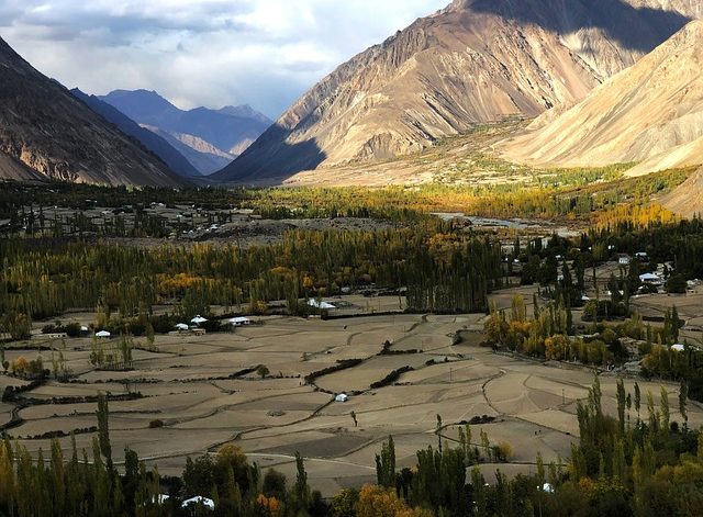
- GIS: Geographic Information Systems are essentially the most crucial software used in environmental studies. It is used for mapping the Earth’s surface and the result is formation of a map that overlays all the features. Features include topography, elevation, landscape, vegetation and so on. It gives us a clear idea of what the environmental conditions of a specific area are like. It is mostly used in management of natural resources or other environmental management or conservation plans.
- Remote Sensing: It is defined as the science of obtaining information about the earth’s surface without actually coming in contact with it. It is done remotely- at a distance using different types of radiation. It utilizes microwaves, thermal waves and infrared sensors all of which are applied in different environmental scenarios. One most common application is in the event of a disaster. Microwaves are most commonly used for recording soil moisture, infrared for flood detection and thermal radiation is typically used to detect fires or fire hazards. Thus, this technology can not only help us in detecting, measuring and recording the various measurements and prepare responses to it but it also enables us to see the extent of the disaster. For detailed information, kindly read: GIS and Remote Sensing in Environmental Science – Applications and Advantages
- Digital Mapping: again a software can be used to prepare digital maps for hazards and evacuation activities. In the event of an environmental hazard (natural or man-made), hazard maps are generated that inform us of the extent of potential damage, and duration. Evacuation activities can efficiently be carried out using this software to form an evacuation plan. This will allow people to navigate a disaster scene more quickly to provide aid to those trapped or relocated.
- Drones: This can allow us to monitor landscapes or collect photographs or even samples from places that are inaccessible to humans. Drones are also used in the aftermath of a disaster to assess the extent of damage caused as a result of it.
- GPS Tracking System: This is the most commonly used technology but in the field of environmental science, it has an important role still. It is mainly used in evacuation activities to prevent the rescuers or volunteer/aid groups to not get disoriented while performing their activities or navigating the scene of disaster.
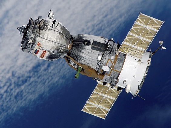
- Satellites: The satellites orbiting around the Earth are the primary source of information we have that provide us with data about the entire planet. Images of the Earth’s atmosphere, the air circulation patterns, landscapes, land formations, water currents and even water depletion levels can be obtained from satellite data. The satellites also provide additional information of various other factors that can affect the life on earth as well as its environment.
Also read: Green Tech: Using CO2 From Air To Produce Useful Products - Artificial Intelligence: AI that mimics human intelligence can greatly help humans learn more about the environment. This i possible by making real time data collection and analysis in a matter of seconds. It can help us obtain the relevant information needed for making more eco-friendly decisions and selecting green alternatives. For more information please read, AI And Its Role In Environmental Protection And Restoration
CONCLUSION:
Although by no means limited to just these options listed above, technology has a vast array of applications. In environmental studies, technology can be a game-changer in mitigating the effects of climate change and making our cities and lives more sustainable and eco-friendly.
You may also be interested in: Blueprint of an Eco-city – How To Create Sustainable Cities?
I hope you all liked this post! Please comment below if you have any suggestions, comments, or feedback! We at #envpk love hearing from our readers! Thanks!