Introduction:
Environmental Science is a broad field with lots of options to choose from in pursuing research as well as industry jobs. However, there are two skills that every student of environmental science should possess in their skill set before or by the time they graduate. These are GIS- Geographic Information System and Statistics.
Check out: What is Environmental Science and Why is it Important?
What is the role of GIS in Environmental Science?
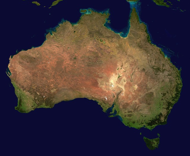
GIS stands for Geographic Information System and it is extensively used in environmental data collection and storage as well as in environmental monitoring. GIS is basically a computer system or software that is used for collecting, displaying, storing and monitor the various landscapes, topography /land surfaces of the Earth.
This is often accompanied by Remote Sensing which utilizes satellite system to capture information from satellites stationed outside the Earth but within the Earth’s orbit in space. Together, GIS and RS can be collectively used to map and model the various interactions between seemingly unrelated objects on the Earth’s surface.
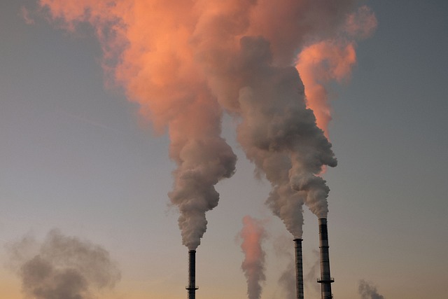
It can help us monitor things such as: the extent of pollution on the land/surface of the earth, in the water, whether the lakes, rivers or coastlines have receded back from the land or expanded into. The status of vegetation mass on the earth’s surface. They can also be used to track and monitor natural disasters like cyclone, floods, earthquakes and can be used in assessments for the amount of damage caused by these natural extreme events.
Related: GIS and Remote Sensing in Environmental Science – Applications and Advantages
What is the Role of Statistics in Environmental Science?
Statistics is also a very important subject in this field of study and for a good reason. The facts and figures, the percentages that we use when quoting how global temperatures have risen by this much, the gallons of water used in a specific industrial process worldwide, the number of trees cut down in a country or how climate change is going to cause significant and irreparable damage by 2030- these are all numbers that are mathematically estimated after calculation by using statistics.
So whenever you come across a statistics such as global temperatures rise by 1.5 degree Celsius, or that the number of trees in Pakistan is being cut down at a rate of 460,000 trees per month; then you should understand that this is only possible by studying environmental statistics and understanding how this knowledge can be applied in real life.
Statistics can help environmental scientists understand the impact of climatic conditions and factors by converting the data they have collected into mathematical models and numbers by accounting for different variables. We can assess in numbers what action of ours can lead to how much damage to the environment or how bad will a choice of a variable in a scenario impact our environment. As we can already see by the fact that knowing that global temperatures have risen globally by 1.5 degrees in the past decade has spurred the developed countries into action that otherwise the simple knowledge of global warming would not have done as much.
Also check out: Scope of Environmental Science Studies in Pakistan
Importance of GIS and Statistics for Environmental Science Students:
These subjects are particularly important for any student of environmental science because of the fact that they will be used in your final research project or thesis.
And it is better to be in possession of these skills before you can graduate as it will vastly increase the hectic process of preparing your research thesis without the added stress of learning to use the software or how to calculate numbers.
Also check out: Lack of Climate Change Research in Pakistan – Need and Importance
In addition, these are generally skills that any good student of environmental science needs to have as earlier you develop them the more easier it would be for you as you pursue your final thesis and subsequently if you choose to pursue a Masters degree and research in the future.
Learning to combine maps and geographical data into one combined map is very beneficial to study the geographical changes and modifications to the land surface or other Earth features in general. A student who is able to learn how to do this will have a skill that will be useful for all time as environment and climate is rapidly changing and it needs constant monitoring.
However, there are still specialized courses being offered for these subjects for those who did not study these at a undergraduate level or missed the opportunity to. This proves how important these subjects are to environmental science and study.
You might also be interested in: List of Environmental Internships in Pakistan For Students
We hope you liked this post! Please comment below if you have any suggestions, comments or feedback! We at #envpk love hearing from readers! Thanks!